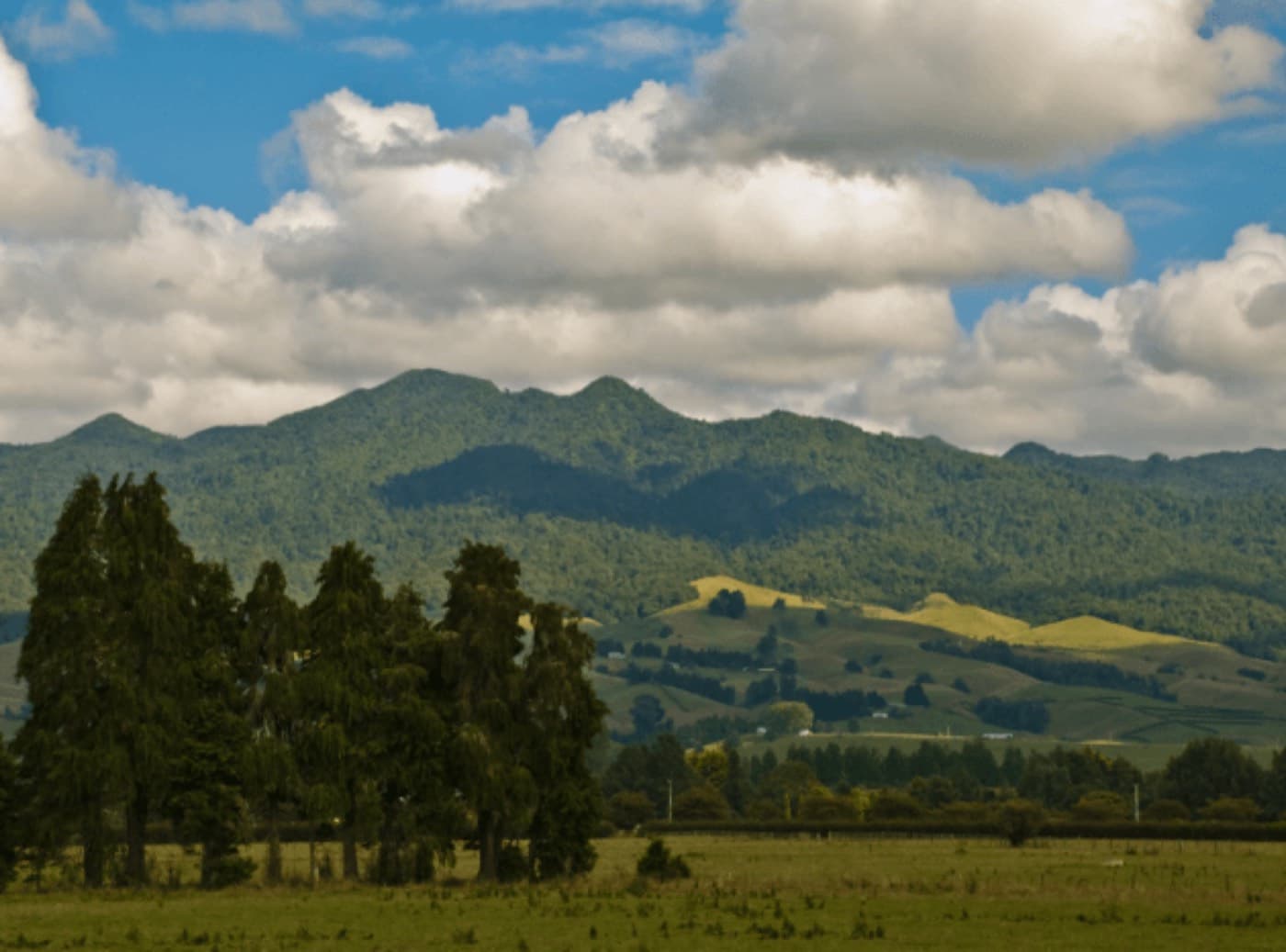
Mount Pirongia is the big forested hump on the western skyline from Hamilton and Te Awamutu. It is an extinct volcano, it tops out at around 959 metres, and it is covered in the sort of dense native forest that most of the Waikato lost a long time ago.
The village of the same name sits at its foot. Between them there is a genuinely good half day, and almost nobody who is not local knows about it.
Pirongia Forest Park
The forest park is the reason to come. Tall Rimu, Kahikatea and Tōtara, tree ferns, moss on everything, and clear mountain streams running down off the volcano. Because the canopy is intact the birdlife is noticeably better than in the surrounding farmland.
There are several access points around the mountain with tracks ranging from twenty minute strolls to serious full day climbs. Most visitors want one of the shorter ones.
- Short forest walks to mountain streams, twenty to forty minutes
- Longer loop tracks through the native bush
- The summit track, a serious full day climb with a summit tower
- Picnic areas at several of the road-end car parks
The summit, and whether you should
The climb to the top of Pirongia is a proper tramp rather than a walk. Expect a long day, steep and muddy sections, and weather that changes quickly. There is a summit tower and a hut near the top, and on a clear day the view runs from Kāwhia Harbour to the Kaimai Range.
If that is not your day out, the lower forest walks give you the best of the bush without the commitment. There is no shame in the twenty minute version, and the trees are the same trees.
Pirongia village
The village is small, historic and pleasant, sitting between the mountain and the Waipā River about ten minutes from Te Awamutu. It has a handful of places to eat and a settled, unhurried feel that fits the rest of the day.
It is also a useful base point. Raglan is about forty minutes west over the hills, Te Awamutu is ten minutes east, and Hamilton is twenty-five minutes north.
What to combine it with
Pirongia works best as the first stop of a westward day. Forest walk in the morning while it is cool and the birds are loud, then over the hills to Bridal Veil Falls and Raglan for the afternoon.
That is exactly the route our half day tour takes: the Pirongia forest walk, the 55 metre Bridal Veil Falls, and Ngarunui Beach at Raglan with a cafe lunch. $695 including lunch.
- Bridal Veil Falls, about forty minutes west
- Raglan and Ngarunui Beach, about forty-five minutes
- Te Awamutu, ten minutes east
- Mount Kakepuku, the volcanic cone visible to the south
Practical notes
- Boots or shoes with grip, the tracks hold mud year round
- The mountain makes its own weather, take a jacket
- Limited phone reception once you are into the park
- No shops at the road ends, bring water
- Clean your footwear at the stations provided to protect against kauri dieback and other spread